

Channel Islands Harbor
Channel Islands Harbor (CIH)
CIH was set up as a second location for Fairwind Yacht Club 20 years ago and has grown from a few members with 1 or 2 boats to over 250 active members with almost 20 boats ranging in size from 14 to 38 feet. We also have kayaks and a duffy boat for members to use.
Our medium and large cruising boats (27 to 38 feet) are located at Peninsula Yacht Marina, 3700 Peninsula Road, Oxnard and our small boats (18 to 25 feet) which includes the duffy boat are at Ventura County Small Boat Marina across the channel at Curlew Way, Oxnard. We also have a J24 racing boat in dry dock close by and 4 Capri 14s which are used for our Boys and Girls club program at Seabridge Marina (behind Vons).
Recent Events

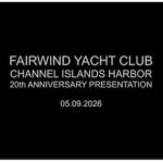
We recently celebrated our CIH 20 year anniversary with about 100 Fairwinders at Seabridge clubhouse. Dave Lumian, who started the CIH group, told the story of how it started, followed by Tom Marshall who was the original owner of Angelsea. Michael Delaney, who joined CIH a few years later and was instrumental in growing the club showed how the club grew and became self sufficient. This was followed by a barbecue lunch and Seabridge pond race on the Capri 14s. For those who missed it, here is a video of the presentation.
Spinnaker Shoot
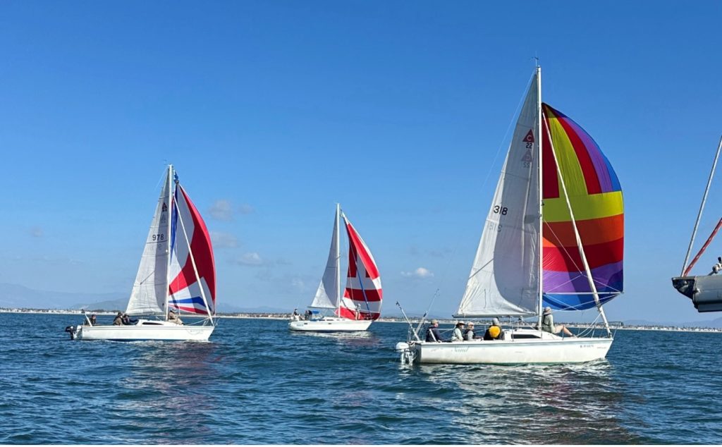
January was our “Spinnaker Shoot,” and it was great seeing so many Fairwind boats out flying their colorful sails. It was also great to get so many of our sailors trained and comfortable with the spinnakers. Hats off to Steve Reagan and all of the members who made this a success.
Sailing Guidelines for CIH Area
Shoals: The channel is dredged annually but there can be minor shoaling in the harbor by the ATON’s at the north end of the entrance channel.
Bridges: The Capri 22’s do not fit under any Channel Islands Harbor bridges. The Capri 14’s can be sailed under the big bridge into the back bay. The Capri 14’s do not fit under the Seabridge pedestrian bridge in the Seabridge Marina.
Port Hueneme Harbor: Do Not Enter! Port Hueneme, one mile east of CIH, is a Restricted Naval/Commercial port.
Lobster and Crab Traps: Fisherman put lobster and crab traps outside of CIH breakwater various times of year. They are only visible by their floats. The floats and lines can entangle prop and/or rudder
Oil Islands: There are four oil islands (platforms) locally off CIH and Ventura. Gina is three miles off CIH towards Anacapa Island. Gale is seven miles off CIH towards Santa Cruz Island. Give the oil islands a wide berth as there may be toxic gases. Do not anchor in the vicinity of the oil islands as there are oil pipe lines. See attached map.
Shipping Lanes: There are commercial shipping lanes in the Santa Barbara channel between the harbor and the Channel Islands. The north bound lane starts about one mile beyond the oil islands. The north and south bound lanes are about a mile wide with a mile buffer. Use extreme caution as the ships are traveling at ~24 kts and have limited ability to change course or stop.
Ventura Harbor: When entering Ventura Harbor sail to the sea buoy and then sail a direct course into the harbor. There are shoals on the east side of the entrance so do not cut the corner when entering or departing. Do not sail between the detached breakwater and the west breakwater. Contact Harbormaster if you wish to dock for lunch.
Anacapa Island: Use caution around Anacapa Island as there are submerged rocks. Always consult a chart when sailing close to the island or anchoring for lunch. There are no safe anchorages for overnight stay at Anacapa.
Santa Cruz Island: Use caution around Santa Cruz Island as there are submerged rocks and wrecks. Always consult a chart when sailing close to the island or anchoring. Brian Fagan’s book “Cruising Guide to Central and Southern California” has detailed information about the island and anchorages.
SeaBee Rifle Range at Point Mugu: The Navy operates a firing range just west of Point Mugu. If sailing in the area monitor Channel 16 for announcements of live fire activity. There will also be a large red flag flying if the range is active.
Naval Live Fire Exercises: The Navy and Coast Guard hold periodic live fire exercises off shore. Most of these exercises are out beyond the Channel Islands and are announced on Channel 16. The Navy and Coast Guard provide Lat and Long coordinates and duration of activity.